


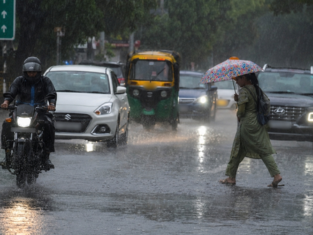
Bhopal, May 30 (IANS) The southwest monsoon has further advanced into Madhya Pradesh, bringing widespread rainfall, thunderstorms, hailstorms and strong gusty winds to several parts of the state.
This significant weather activity has offered much-needed relief from the intense summer heat while raising concerns over possible damage to crops and infrastructure.
The IMD has issued warnings for the coming days. Heavy rainfall accompanied by thunderstorms, lightning, hail and gusty winds of 50-60 kmph is likely at isolated places in Mandsaur and Neemuch on May 30-31.
Similar intense activity is expected in districts including Gwalior, Datia, Bhind, Damoh, Chhatarpur, Tikamgarh and Niwari.
From May 31 to June 3, thunderstorms and strong winds will continue across large parts of the state, including Rajgarh, Agar, Shahdol, Sehore, Dewas, Indore, Ujjain, Jhabua and other districts, with isolated heavy spells possible.
According to the India Meteorological Department’s Meteorological Centre in Bhopal, heavy rainfall was recorded in many districts based on observations at 8.30 a.m. on May 30.
Gormi in Bhind district received the highest rainfall of 72 mm, followed by Narwar with 44 mm, Tendukheda-Narsinghpur at 38 mm, Berad with 31 mm, and Shujalpur and Mohan Garh both recording 29 mm. Other areas included Baldevgarh (27 mm), Niwari (25 mm), and several places in the 15-22 mm range.
Strong winds accompanied the showers, with gusts reaching 70 kmph in Ashoknagar, 67 kmph in Gwalior and Shivpuri, and 59 kmph in Sehore.
Hailstorms were reported in Shivpuri, Morena, Sagar and Sheopur districts.
Thunderstorms and lightning affected multiple regions, including the Chambal, Gwalior, Sagar and Ujjain divisions (except Neemuch), Rewa division (except Singrauli), Shahdol division, and districts such as Jhabua, Dhar, Indore, Dewas, Katni and Dindori.
The northern limit of the monsoon is progressing steadily, with favourable conditions for further advancement into more parts of the Arabian Sea, Lakshadweep, Kerala, Tamil Nadu and the Bay of Bengal over the next 4-5 days.
A Western Disturbance over northwest Uttar Pradesh and associated troughs across Pakistan, Rajasthan, Madhya Pradesh and Chhattisgarh are contributing to this active weather pattern.
Authorities have urged residents to remain cautious, especially during afternoon hours. People are advised to stay hydrated, avoid unnecessary travel during peak storm periods, secure loose objects, and protect livestock and standing crops from hail and strong winds.
Farmers have been asked to take precautionary measures for their fields and avoid exposure during thunderstorms.
This early monsoon surge is expected to ease heatwave conditions significantly while boosting agricultural prospects, though officials continue to monitor the situation closely.
–IANS
sktr/pgh